Panning the Map while using the Enhanced Search Widget
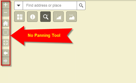
Notice, there is no specific Panning Tool included in the Web App.
The reason being that Panning is always active by default.
You can click and drag the map in any direction anytime, except when you have one of the drawing tools active in the Enhanced Search Widget, Identify Widget, Measurement Widget or Draw Widget.
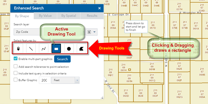
In this example, the Extent Drawing Tool is active. It is expecting you to draw a rectangle by clicking and dragging. You cannot pan the map while in this mode.
Any active drawing tool takes precedence over the default Panning functionality.
So how would you pan the map if you need to?
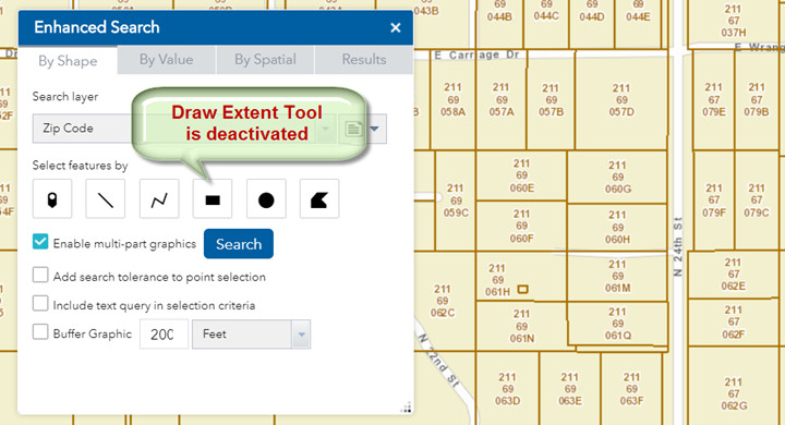
The solution is to deactivate the drawing tool by clicking on it.
Click on the Draw Extent Tool. It is no longer highlighted in blue.
The Draw Extent Tool is now deactivated.
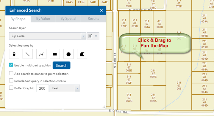
You can now Pan the map by clicking on the map and dragging it.