Search by Spatial Analysis
Spatial Analysis is a very powerful feature of this Web Application.
You can find all the Zip Codes that fall within a City.
You can find all the Sections that intersects a Zip Code.
You can find all the Sections that are within 2 miles of a Zip Code.
You can find the Sections that touches a given Section.
To run any kind of Spatial Analysis, you must first have something selected.
This means you must first make a selection either by the value of an item or by drawing a shape.
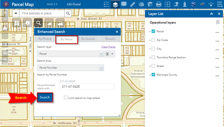
Refresh the Web App to begin this exercise.
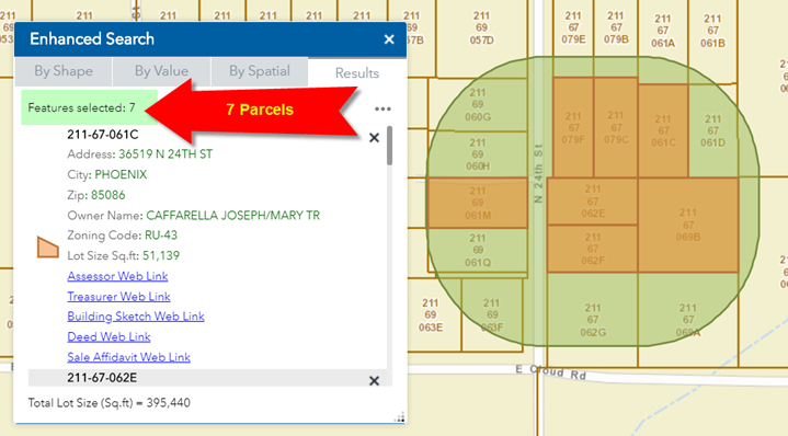
Press Search
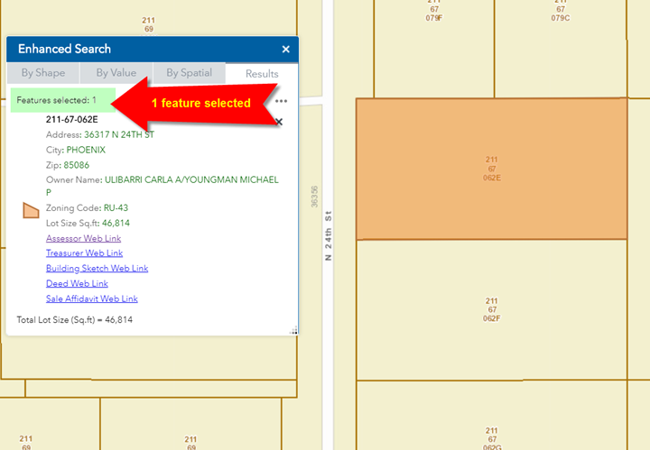
The Map zooms to Parcel 211-67-062E
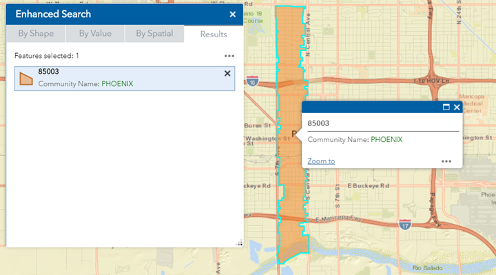
The Results pane shows that one feature has been selected.
You must have at least one feature selected to run the Spatial Tools.
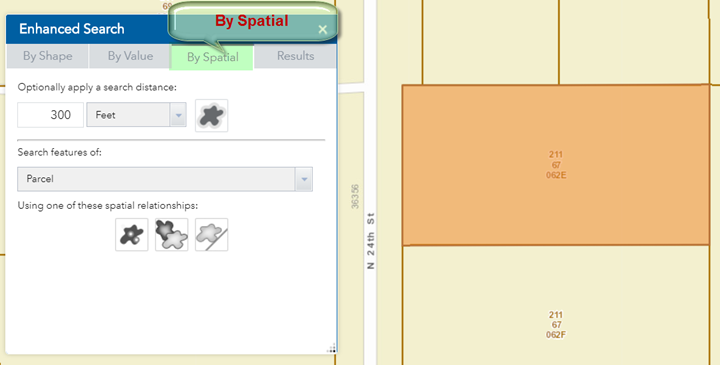
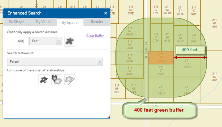
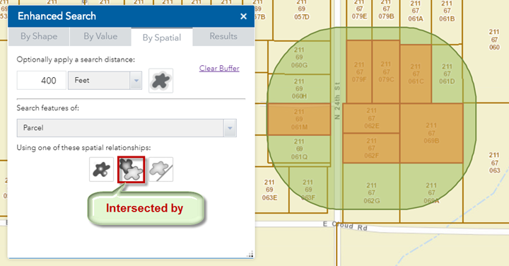
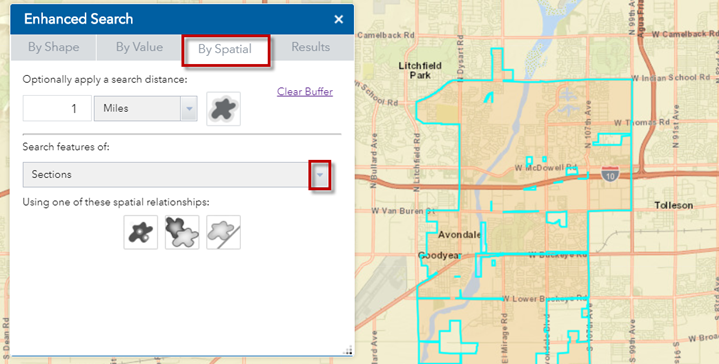
Open the By Spatial Tab.
You are going to draw a 400 feet buffer around this selected Parcel and then find:
-
All the Parcels that are fully contained within this buffer
-
All the Parcels that intersect this buffer.
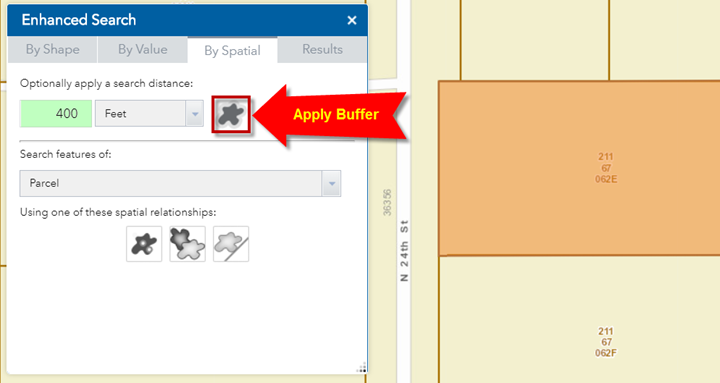
Set the buffer distant to 400 feet.
Click on the Apply Buffer Tool.
This draws a 400 feet green buffer around the selected parcel.
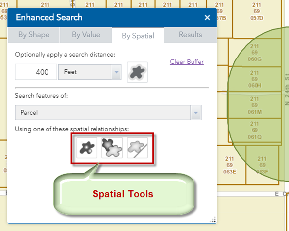
There are three Spatial Tools.
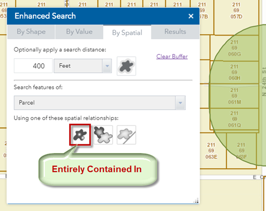
Click on the first Spatial Tool to find all the Parcels that are entirely contained in the buffer.
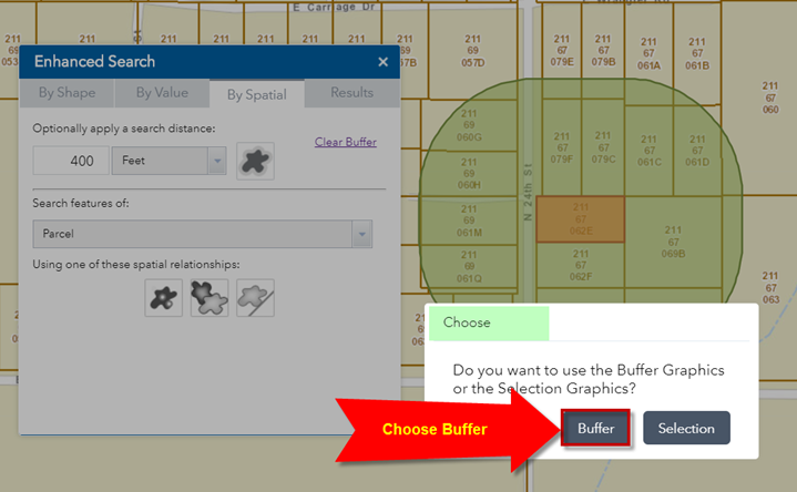
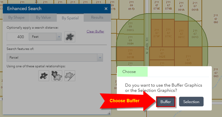
Choose the Buffer option
There are 7 Parcels entirely contained within the green buffer.
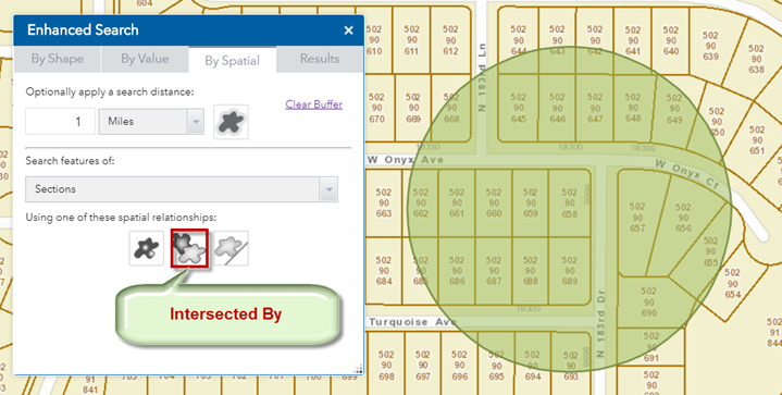
Open the By Spatial Tab
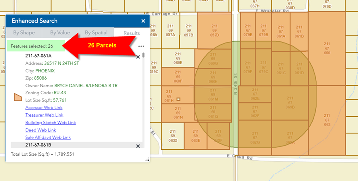
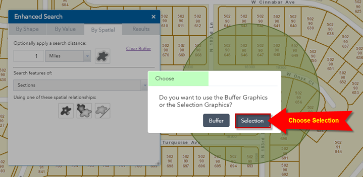
Click on the Intersected By Tool.
Choose the Buffer option.
There are 26 Parcels that intersect the green buffer.
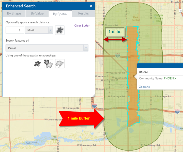
Next, you will find all Sections that lie within 1 mile of a Zip Code.
Refresh your Web App.
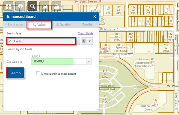
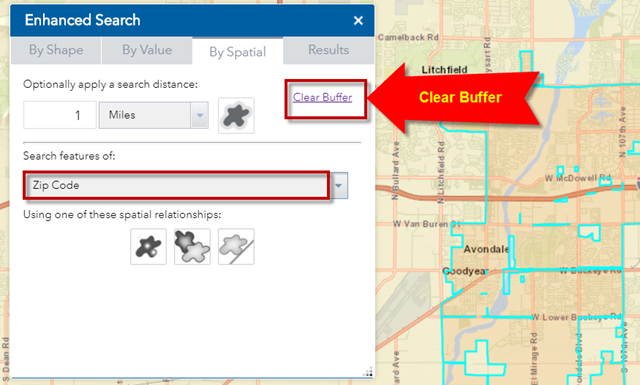
Set your Search Layer = Zip Code
The default Zip Code = 85003
Press Search.
The map zooms to Zip Code 85003
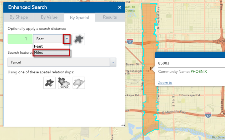
Open the By Spatial Tab
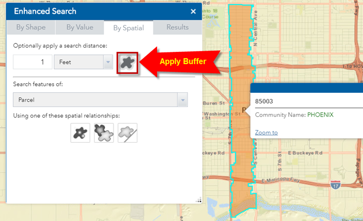
Set the Buffer Distance to 1 mile
Apply Buffer
This draw a green 1 mile buffer around your selected Zip Code 85003.
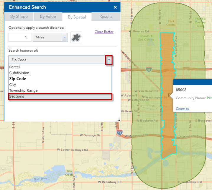
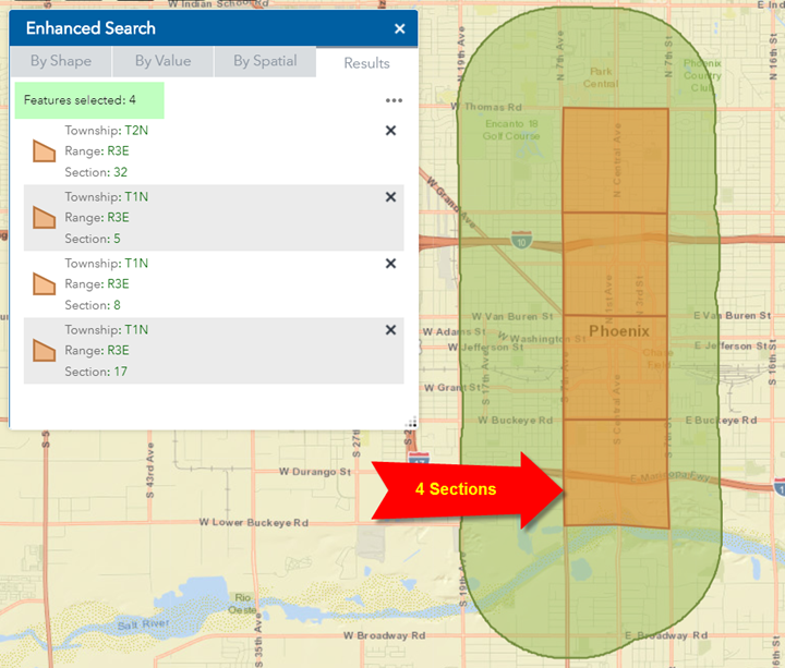
You are going to find all the Sections that fall entirely within this buffer zone.
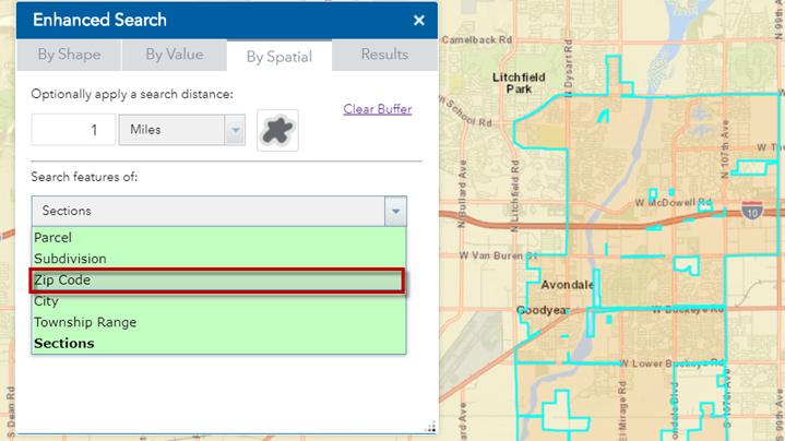
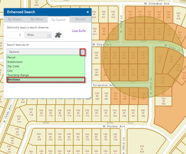
Click on the down arrow and select Sections from the list of Layers.
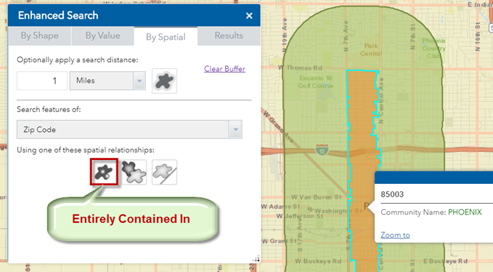
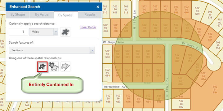
Click on the Entirely Contained In tool.
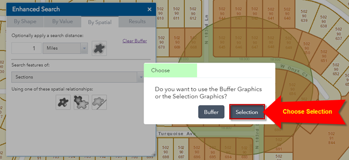
Choose the Buffer option.
There are four Sections entirely contained within this buffer zone.
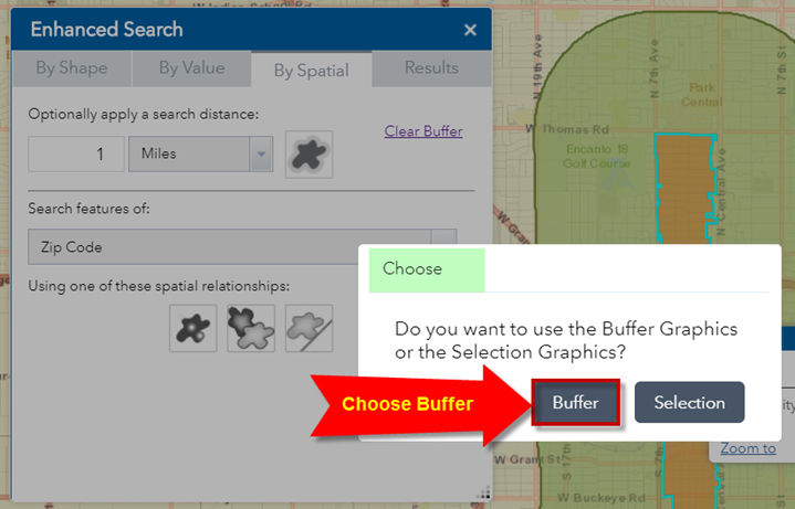
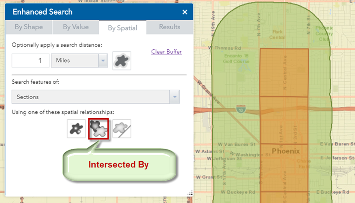
Open the By Spatial Tab.
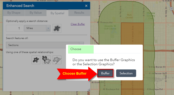
Click on the Intersected By Tool.
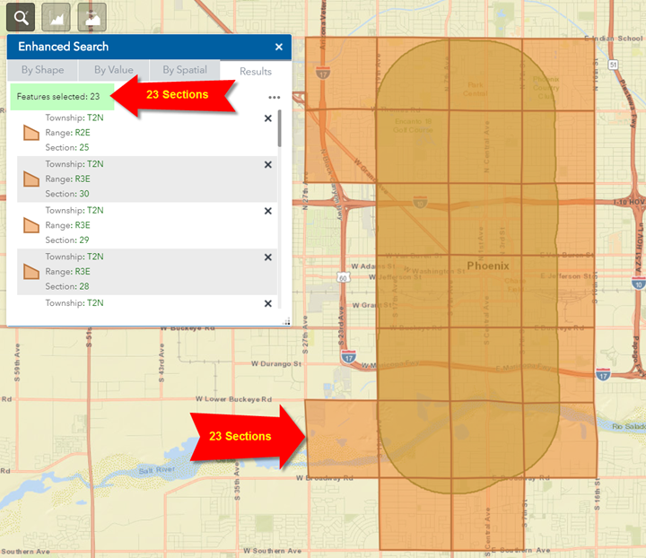
Choose the Buffer option.
There are 23 Sections that intersect this green buffer.
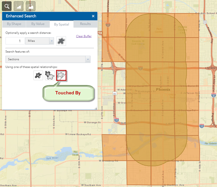
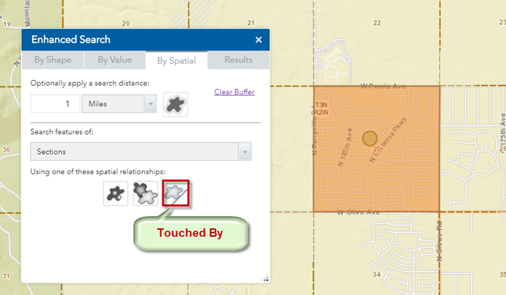
You can also find the Sections that touch the selected Sections.
Open the By Spatial Tab.
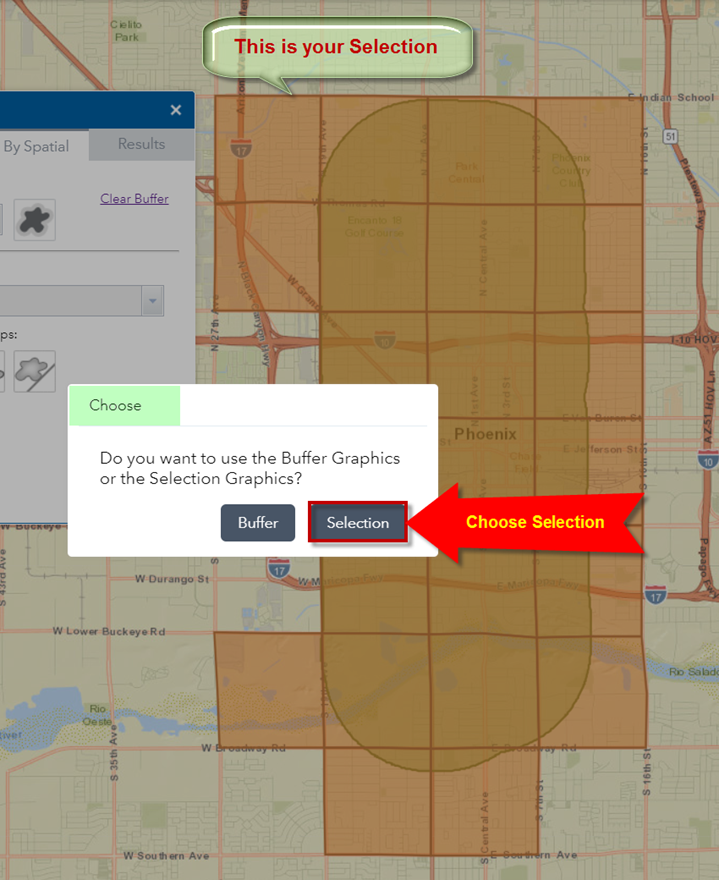
Click on the Touched By Tool.
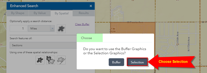
This time, choose Selection.
You are trying to find the Sections that touch the current selection of Sections highlighted in orange, not the buffer.
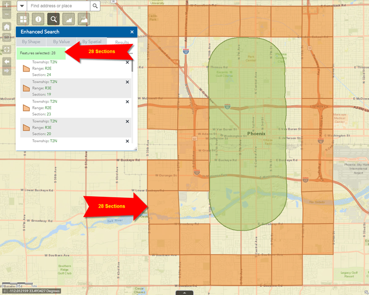
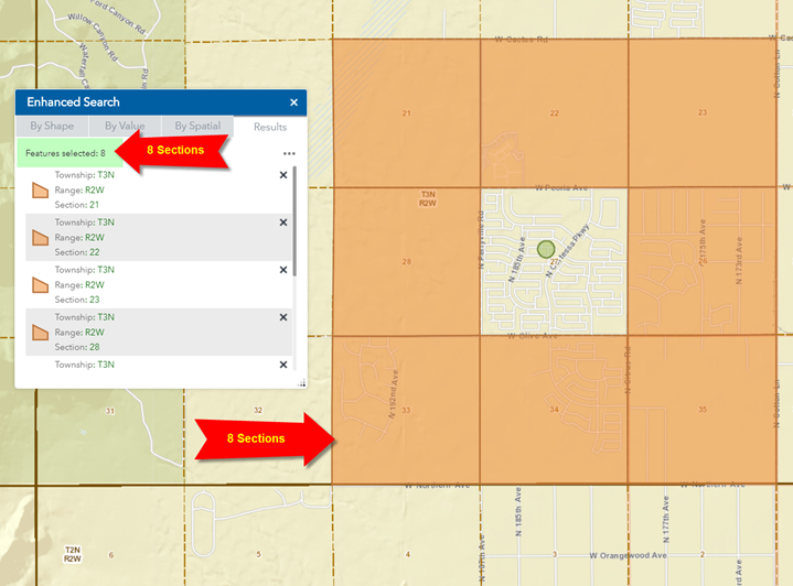
There are 28 Sections that touch the previous set of Sections.
You have found all Sections that border the Sections within 1 mile of Zip Code 85003.
To recap what you just did:
You selected Zip Code 85003
You created a 1-mile buffer around your selected Zip Code.
You found all the Sections that intersect this buffer.
You located all the Sections that touch them.
As you can see, these are powerful Spatial Tools that can be used with a few mouse clicks.
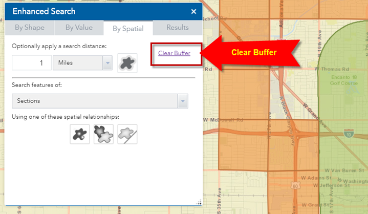
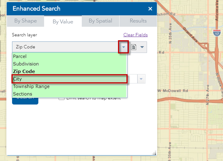
Next, you will find all the Zip Codes within a City.
Open the By Spatial Tab.
Clear the Buffer
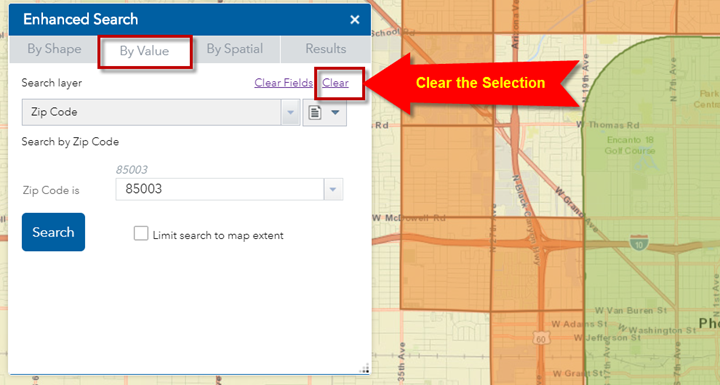
Open the By Value Tab.
Clear the Selection.
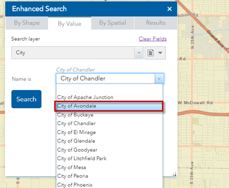
Select City as your Search Layer.
Select City of Avondale
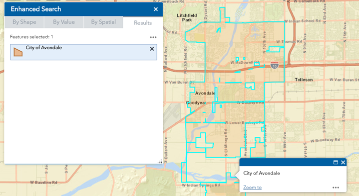
Press Search
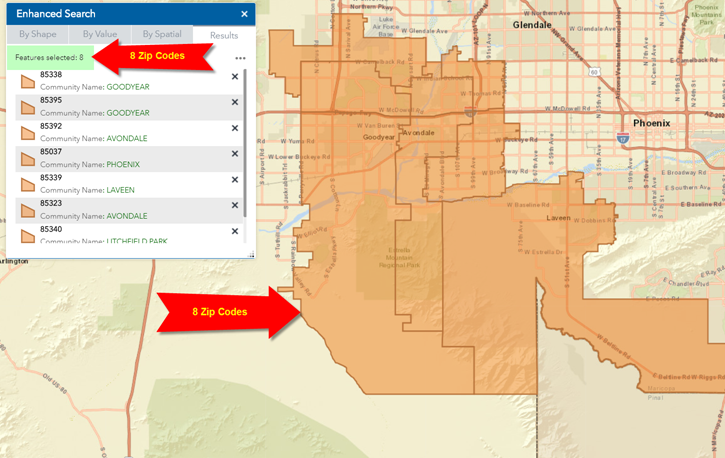
The map zooms to the City of Avondale. It is highlighted in orange.
Open the By Spatial Tab.
Notice, the search layer is pointing to Sections.
You want to search for features in the Zip Code Layer.
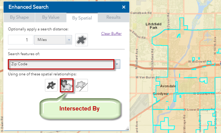
Click on the down arrow and select the Zip Code Layer.
Clear the Buffer.
Click on the Intersected By Tool.
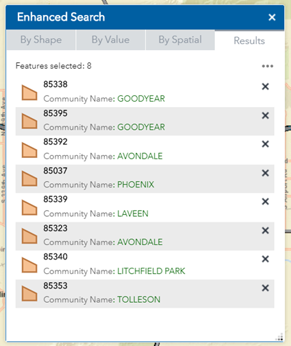
There are 8 Zip Codes that intersect the City of Avondale.
What does this mean?
If you have a Parcel in the City of Avondale, the only possible Zip Codes are:
85338
85395
85392
85037
85339
85323
85340
85353
If your Parcel data shows any other Zip Code, it must be an error.
This is one way to verify your data.
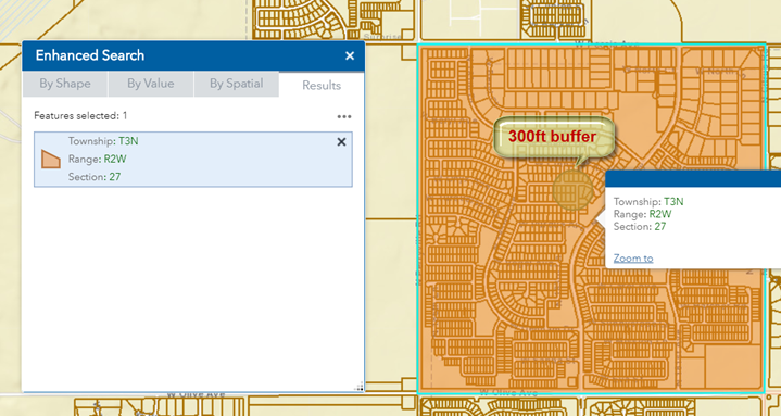
Next, you are going to select a group of Parcels by drawing a shape and then use one of the Spatial Tools to find the Sections that intersects it.
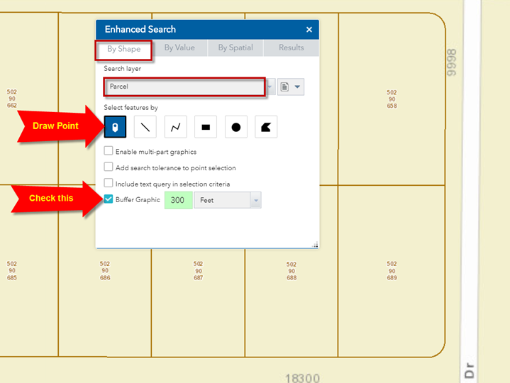
Open the By Shape Tab
Clear the Selection
Clear the Buffer
Zoom in closer until you see the Parcels.
Set your Search Layer = Parcel
Check the Buffer Graphic option
Set your buffer distance = 300 feet
Activate the Draw Point Tool.
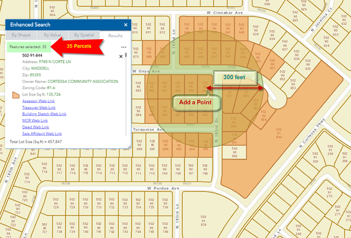
Add a point on the map.
This generates a 300 feet buffer around your point and selects all the Parcels that intersects the buffer.
In this example, 35 Parcels are found.
With 35 features in your selection, you can now apply any of the Spatial Tools to find features that fall within, intersects, or touches your selection.
Open the By Spatial Tab.
From the drop down List of Features select Sections
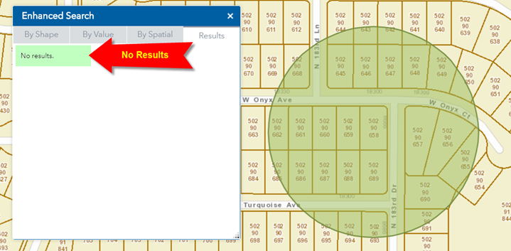
Click on the Entirely Contained In Tool.
Choose the Selection option.
You are trying to find the Sections that are entirely contained within the selected Parcels.
You get a message saying “No results”
What happened?
The selection area that you defined is not large enough to hold a Section.
You must use the Intersected By Tool.
Go back to the By Shape Tab.
Click on the Intersected By Tool.
Choose Selection.
Note: Even though your selected Parcels are not highlighted on the map, they are still in memory.
The map zooms to the Section where your selected Parcels reside.
For comparison, you can see how small the 300ft buffer is relative to the Section.
In such cases, you must use the Intersected By Tool.
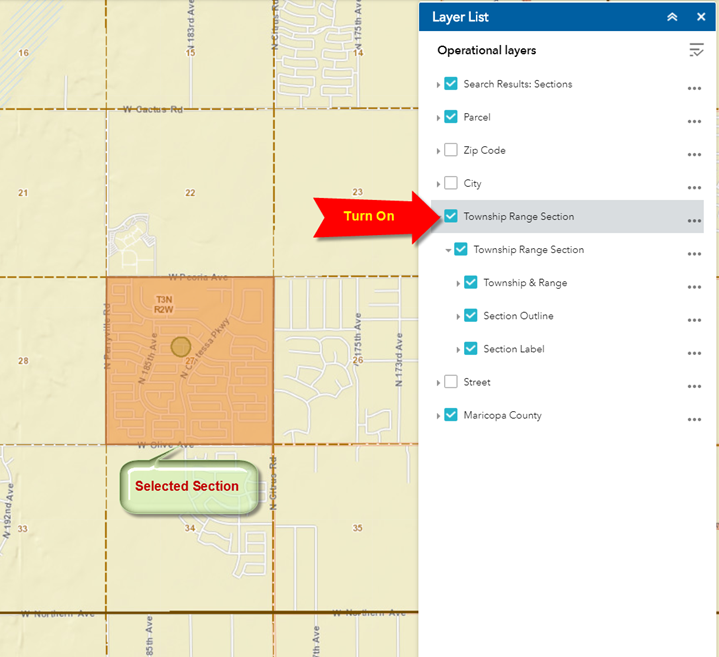
Turn on the Township Range Section Layer Group in the Layer List Widget.
You can now view the selected Section in relation to the neighboring Sections.
How can you find the neighboring Sections that touch your selected Section?
Open the By Spatial Tab.
Click on the Touched By Tool.
Choose Selection
There are 8 Sections that touches your selected Section.